


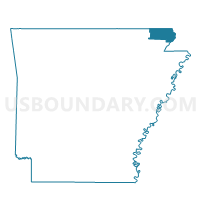
Johnson Voting District, Clay County, Arkansas
About
Outline

Summary
| Unique Area Identifier | 526129 |
| Name | Johnson Voting District |
| County | Clay County |
| State | Arkansas |
| Area (square miles) | 24.41 |
| Land Area (square miles) | 24.38 |
| Water Area (square miles) | 0.03 |
| % of Land Area | 99.87 |
| % of Water Area | 0.13 |
| Latitude of the Internal Point | 36.32426150 |
| Longtitude of the Internal Point | -90.38967200 |
Maps


Graphs
Select a template below for downloading or customizing gragh for Johnson Voting District, Clay County, Arkansas


Neighbors
Neighoring Voting District (by Name) Neighboring Voting District on the Map
- Bennett & Lemmons Voting District, Clay County, AR
- Bradshaw & Haywood Voting District, Clay County, AR
- Cache & Wilson Voting District, Clay County, AR
- Knob Voting District, Clay County, AR
- West Oak Bluff Voting District, Clay County, AR
Top 10 Neighboring County Subdivision (by Population) Neighboring County Subdivision on the Map
- West Oak Bluff township, Clay County, AR (1,274)
- Bradshaw-Haywood township, Clay County, AR (645)
- Bennett-Lemmons township, Clay County, AR (643)
- Cache-Wilson township, Clay County, AR (477)
- Knob township, Clay County, AR (243)
- Johnson township, Clay County, AR (225)